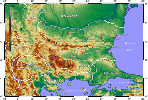
Topographic map
Topographic vs. Geologic Maps
Locating and identifying points on a map is one of the most common exercises done by students today. Considering how many types of maps there are, this makes it crucial to learn the key differences between them in order to understand what they depict. Currently, some of the most common map types used in schools include topographic and geologic maps, which provide different information regarding the Earth’s surface.
If you look at a topographic and geologic map side by side, you’ll immediately notice the visual difference between the two. The geological map is not only composed of shapes and figures, but is also colored in various shades to depict certain areas. On the other hand, the topographical map is a mass of lines and curves with very little colors to separate one land area from another.
This is because the two maps show very different aspects of the world. In essence, a topographical map is an effort to create a three-dimensional version of an area using contour lines to show the elevation of the land mass. On the other hand, a geologic map is a geological representation of the land mass, providing information like the type of soil found in the area, rocks, bedding planes, folds, faults, and other structural features.
Since the two maps provide very different information to the user, it isn’t surprising that they are utilized for different purposes. A topographical map may be used for various reasons ranging from mining and architecture to hiking. On the other hand, a geologic map is termed as a “special purpose” map, and is mainly used by geologists during research. In some cases, a geologic map is superimposed with a topographic map to provide further information for its users.

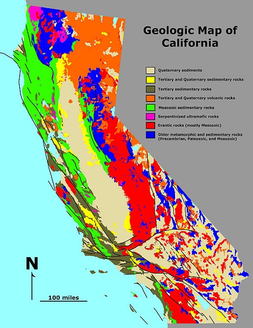
Geologic Map
The legend or colors used in labeling maps are universal in most countries. Naturally, the legend of a map is usually provided to avoid confusion for its users. When it comes to a geologic map, geologists usually make use of two different orientation measurements for the map: lines and planes. Basically, planes may be labeled as either “strike” or “dip,” which is shown as a line in the map perpendicular to the biggest slope on the surface. As for linear features, the symbol used is a single arrow featuring the “trend” or “plunge” of the geological figure.
In the case of the Unites States, the United States Geological Survey is responsible for producing the country’s topographical map. However, a geologic map is not composed for the entire country, and the decision to make one is usually left to the state. Hence, some states have no geologic maps or have ones that are lacking in information, while others have highly detailed geologic maps at their disposal.
As mentioned above, some maps actually have a geologic pattern transposed on a topographical one. This is usually done in the United States with other maps being included in the mix as well. For this reason, it is important to understand the symbols, legends, and other factors required for a proper reading of the map to avoid confusion. Ideally, individuals who want to utilize a map – regardless of it being topographic or geologic – should undergo proper training or lessons in order to understand how these maps should be interpreted.
Summary:
1.Topographic maps are three-dimensional representations of landmass that use contour lines to depict elevation.
2.Geologic maps are special purpose maps that show the geological properties of land – rock types, rock age, bedding planes, folds, and faults.
3.Topographic maps are used for various purposes such as hiking or mining.
- Differences Between Fraternity And Sorority - January 8, 2014
- Differences Between Lucite and Plastic - January 7, 2014
- Differences Between Oil and Butter - January 6, 2014