Difference Between Cartographer and Photogrammetrist
You may have come across terms such as cartographer, photogrammetrist or even land surveyor. Most people combine the roles of all three. While their roles may be similar, each has clearly defined job specifications. For instance, surveyors measure land to determine land, air and water boundaries, among other vital roles. The role of cartographers includes the collection of geographic, political and cultural data to create maps. Photogrammetrists use various details such as photos to create detailed maps. As you can see, their roles are closely related, though different. Let’s clearly define the differences between cartographer and photogrammetrist below.
What is a Cartographer?
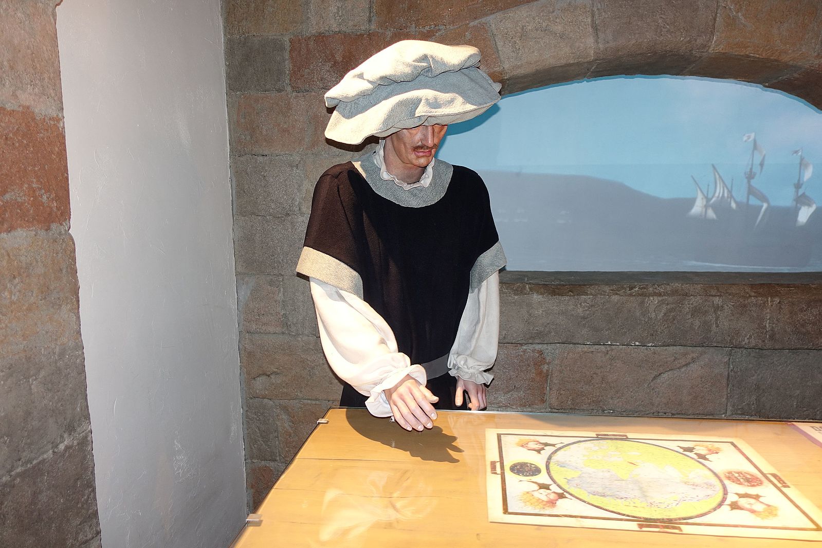
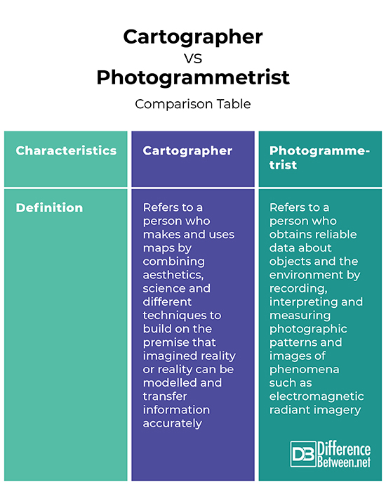
A cartographer is a person who makes and uses maps. Cartographers combine aesthetics, science and different techniques to build on the premise that imagined reality or reality can be modelled and transfer information accurately.
Traditional cartography is based on:
- Setting the maps agenda and selecting traits such as land masses or political boundaries
- Representation of the terrain of the mapped object
- Elimination of the characteristics of the mapped object
- Reduction of the complexity of the features set to be mapped
- Ensuring clear elements of the map to convey the intended message to the audience
Modern cartography has replaced traditional cartography. Modern cartography includes practical and theoretical foundations of geographic information science and geographic information systems. These roles are carried out by a cartographer.
Among the roles of a cartographer include:
- Collection of geographic data
- Creation of visual data representations
- The examination and compiling of data from reports, surveys, satellite images and aerial photographs.
- The preparation of maps both in graphic and digital forms
- Revising and updating charts and maps
What is a Photogrammetrist?
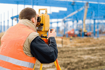
A photogrammetrist is a person who obtains reliable data about objects and the environment by recording, interpreting and measuring photographic patterns and images of phenomena such as electromagnetic radiant imagery. Photogrammetry is closely related to the geographic field that deals with geometric features via photographic images. Photogrammetrists focus on mapping and measuring the earth’s surface by using the photographs to evaluate, gain and map geographic data. The mapping enables them to see the operations of airborne cameras, oversee ground and aerial surveys and the capturing of images.
The roles of photogrammetrists include:
- Planning satellite and aerial surveys
- Collecting and analysing various types of data such as distance and elevation
- Developing base maps
Similarities between Cartographer and Photogrammetrist
- Both often develop mobile maps and online maps
- Both perform surveys and create maps to help in regional and urban planning
Differences between Cartographer and Photogrammetrist
Definition
A cartographer is a person who makes and uses maps by combining aesthetics, science and different techniques to build on the premise that imagined reality or reality can be modelled and transfer information accurately. On the other hand, a photogrammetrist is a person who obtains reliable data about objects and the environment by recording, interpreting and measuring photographic patterns and images of phenomena such as electromagnetic radiant imagery.
Cartographer vs. Photogrammetrist: Comparison Table
Summary of Cartographer vs. Photogrammetrist
A cartographer is a person who makes and uses maps by combining aesthetics, science and different techniques to build on the premise that imagined reality or reality can be modelled and transfer information accurately. On the other hand, a photogrammetrist is a person who obtains reliable data about objects and the environment by recording, interpreting and measuring photographic patterns and images of phenomena such as electromagnetic radiant imagery. Both perform aerial surveys and create maps to aid in regional and urban planning.
What is the job of a Photogrammetrist?
The role of a photogrammetrist is to create detailed maps using various details such as photos.
How does a cartographer and Photogrammetrist use geometry?
The knowledge of geometry is vital when measuring different sizes and shapes as well as plotting and drawing objects. Both cartographers and Photogrammetrists use geography from the creation of a network of points and even measuring the angles and distances between them.
How is photogrammetry related to cartography?
Both collect, measure and interpret geographic data to create and update maps that are used for education and regional planning.
What is the difference between a cartographer and a geographer?
While cartographers focus on mapmaking, geographers involve the study of how the natural environment impacts human society.
Is a cartographer a scientist?
Yes. A cartographer is a scientist.
What is cartography very short answer?
Cartography is the science of drawing maps.
- Difference Between Profit Center and Investment Center - July 2, 2022
- Difference Between Anti-Trust and Anti-Competition - June 6, 2022
- Difference Between Stocktaking and Stock Control - June 6, 2022
Search DifferenceBetween.net :
Leave a Response
References :
[0]Future U.S. Workforce for Geospatial Intelligence. National Research Council, Policy and Global Affairs, Board on Higher Education and Workforce, Division on Earth and Life Studies, Board on Earth Sciences and Resources, Committee on the Future U.S. Workforce for Geospatial Intelligence. National Academies Press Publishers, 2013. https://books.google.co.ke/books?id=7RF1AgAAQBAJ&printsec=frontcover&dq=Difference+between+Cartographer+and+Photogrammetrist&hl=en&sa=X&ved=2ahUKEwifm_-qhYHyAhXB8OAKHSfCAPQQ6AEwAXoECAsQAg#v=onepage&q=Difference%20between%20Cartographer%20and%20Photogrammetrist&f=false
[1]Taylor D & Rhind D. Cartography Past, Present and Future: A Festschrift for F.J. Ormeling. Elsevier Publishers, 2013. https://books.google.co.ke/books?id=pNX-BAAAQBAJ&printsec=frontcover&dq=Difference+between+Cartographer+and+Photogrammetrist&hl=en&sa=X&redir_esc=y#v=onepage&q=Difference%20between%20Cartographer%20and%20Photogrammetrist&f=false
[2]D.R. Fraser Taylor. Geographic Information Systems: The Microcomputer and Modern Cartography. Elsevier, 2013. https://books.google.co.ke/books?id=RNr-BAAAQBAJ&printsec=frontcover&dq=Difference+between+Cartographer+and+Photogrammetrist&hl=en&sa=X&redir_esc=y#v=onepage&q=Difference%20between%20Cartographer%20and%20Photogrammetrist&f=false
[3]Image credit: https://www.thetempconnection.com/wp-content/uploads/2020/07/Cartographers-and-Photogrammetrists-Career-Information.png
[4]Image credit: https://commons.wikimedia.org/wiki/File:World_of_Discoveries-cartographer_(2).JPG